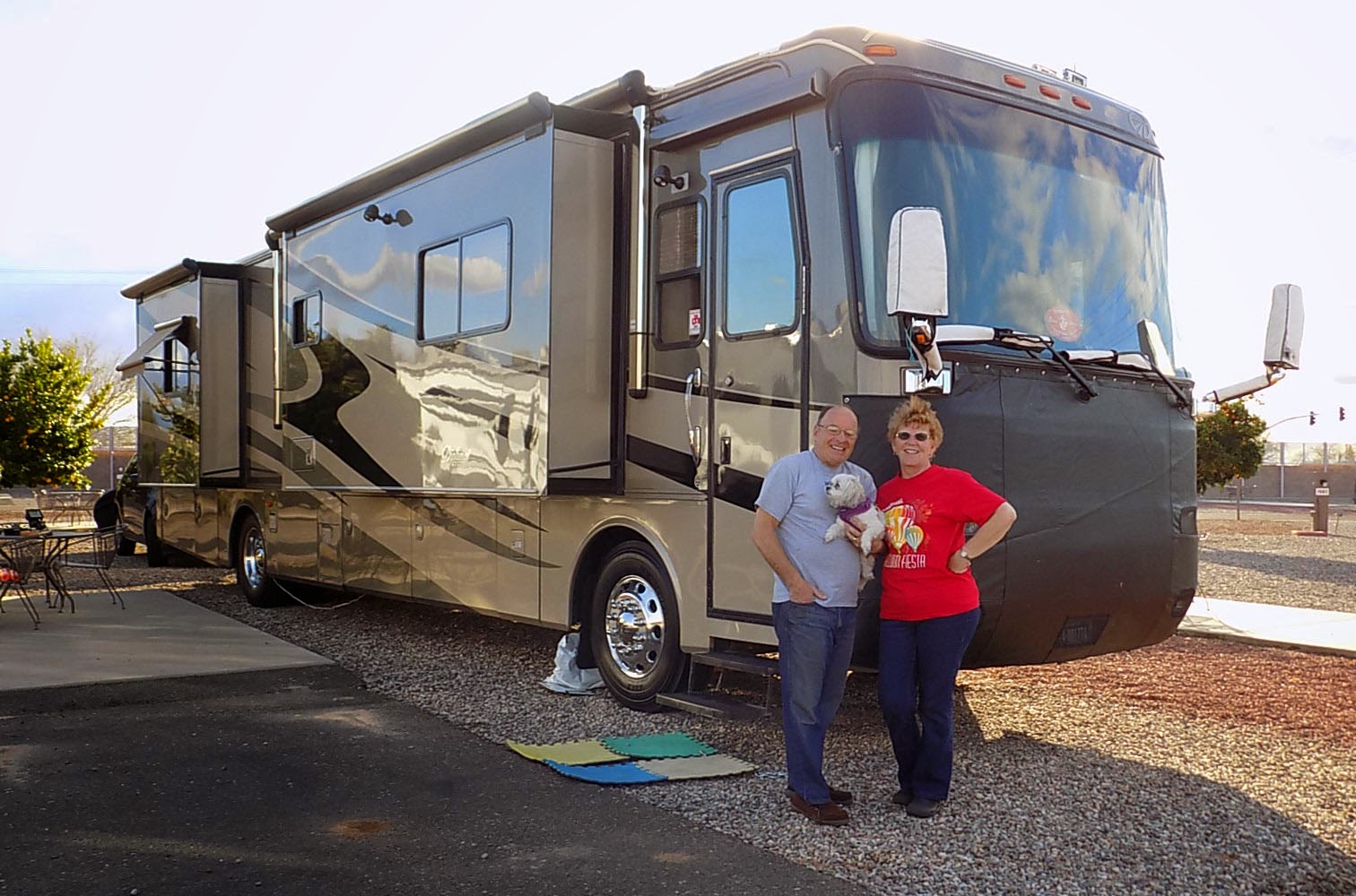
July 12th we left the Yosemite area for an area outside San Francisco called Fairfield. We were staying at Travis Air Force Base. We were so happy to see grass again. Ever since we left Texas, our sites have been gravel, sand or dirt. It’s so hard to keep things clean! Our poor dog has gotten a lot of baths this year! We stayed at Travis 2 weeks, met some very nice people & got a chance to do some sightseeing. There were a lot of “jack rabbits” there. They had really long legs & ears. I tried to get a pic when they were running but they were too quick for me.

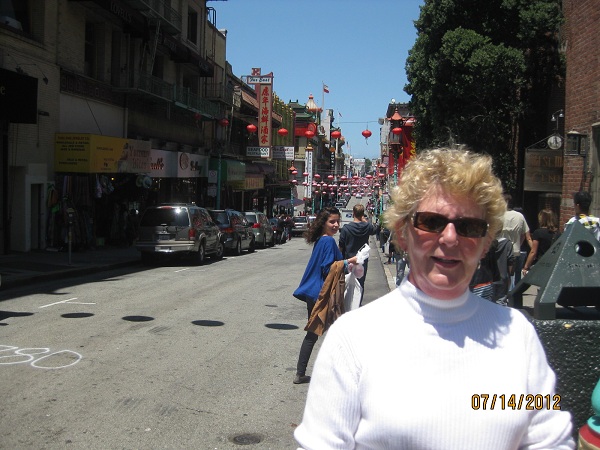 |
| Karen in China Town |
We were about an hour outside San Francisco so we decided to take the train for our day in the city. We certainly got a workout that day. Our first stop was China town, which was an uphill walk from our train stop. We wandered around there for a couple hours, had some egg rolls & did some window shopping.
 |
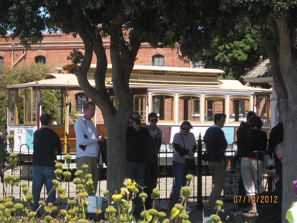
| Collins riding the cable car |
When we were ready to go down by the bay, we decided to catch a Trolley. That was easier said than done. About 6 full ones passed us by, before we were able to hop aboard. It was packed. I was squished inside & Collins was hanging on outside.
 |
| Crooked Street |
We went up & down hills, passed the most crocked street & finally reached the very end (or beginning) of the Trolley route at the San Francisco Bay.
 |
| High on a Hill in San Francisco |
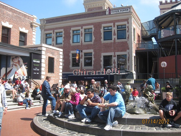
We walked along the park by the bay for awhile & down to Ghirardelli Square. There was chocolate in many flavors & an ice cream parlor with more chocolate items then you can imagine. After we got our share of Chocolate goodies, we continued our walk toward the piers.

 |
| Street Car |
 |
| Trolly |
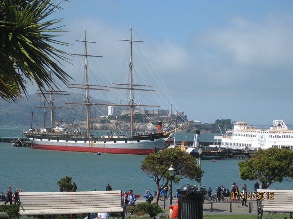 |
| San Francisco Bay with Alcatraz in background |
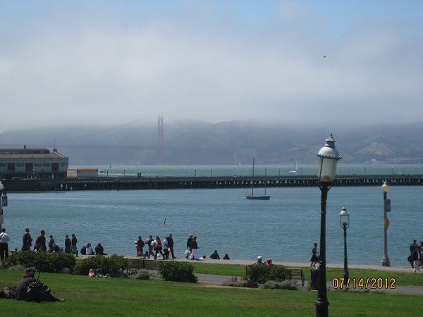 |
| San Francisco Bay with Golden Gate Bridge in Background |
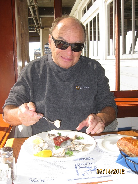 |
| Collins enjoys some oysters |
By this time we were ready for some real food so we stopped into one of the seafood restaurants along the pier for a fish dinner. After a filling & delicious dinner, we finished our walk along Pier 39.
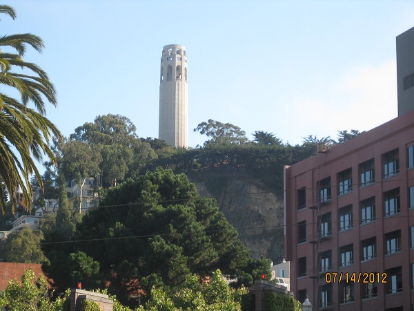 |
| Telegraph Hill |
At that point, we decided it was time to head for home & wandered back to the train station. We were totally worn by the time we returned to our comfy little home.
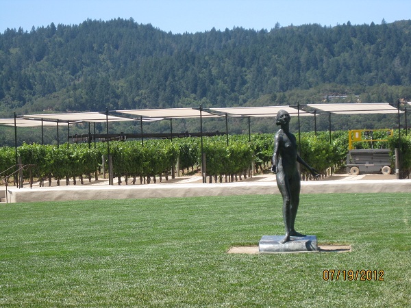 |
| Napa Winery |
Another day, we decided to drive to Napa Valley to check out some of the nice little towns & wineries. Now some of you know, neither one of us are much into wine, so it was more looking around than anything else for us.
.JPG)
 |
| Winery |
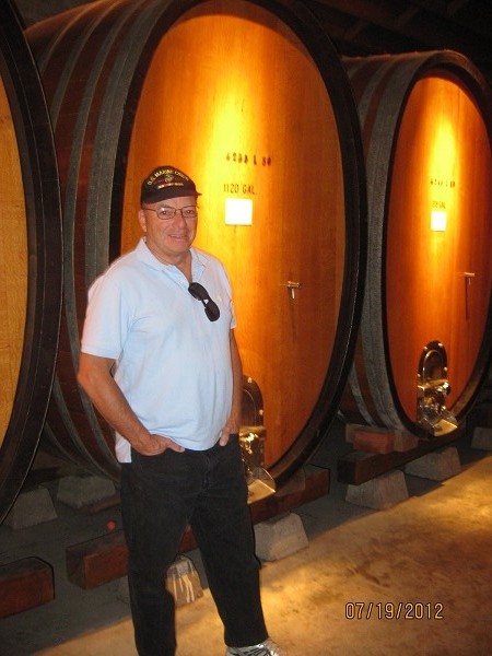
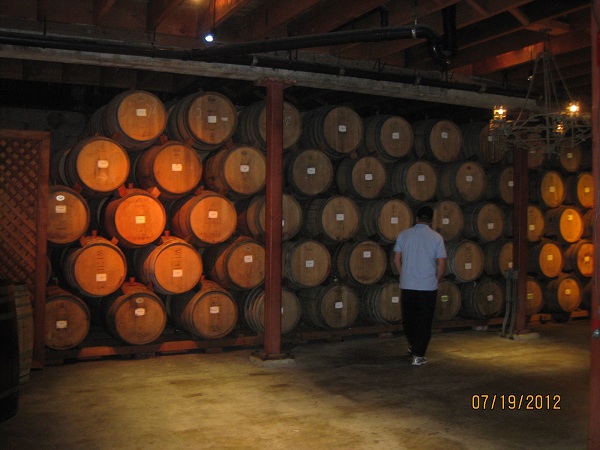
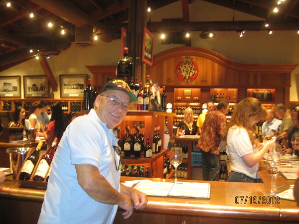
We did taste some sweeter wines at one of our stops, but nothing really grabbed us. Collins says we need something they crushed the day before! Some of these wineries are large, with pretty gardens & beautiful settings.

We also drove to the Culinary Institute, which is housed in an old monastery. We didn’t eat there since we arrived between meals, but we went inside & looked around a little. It is a huge facility & has students from around the world.
We bought a new bike rack while in Fairfield. The day we left Yosemite, one of the bikes fell off the rack we had purchased when we bought the bikes. Thankfully, it happened just as we pulled out of the park & several nice people honked to let us know. We had the bikes on the back of the car & we can’t see the back so we had no idea. We have a rear camera in the RV but you can’t see what’s going on at the back of the car. After we got the bikes secured again, we made a decision to buy a rack that goes into a trailer hitch on the car & the bikes set into the rack. However, we didn’t have a trailer hitch so we had to get that installed. We found a place close to the base to get that taken care of. We both felt a lot better the next time we traveled with the bikes.
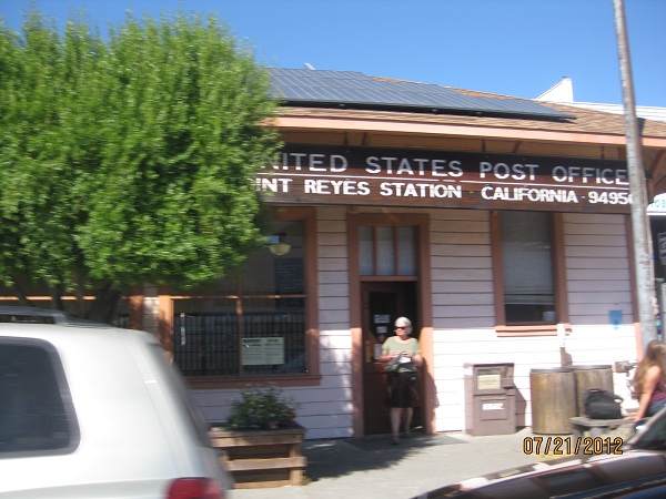 |
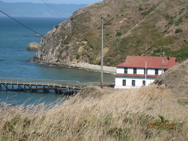
| Port Reyes Post Office |
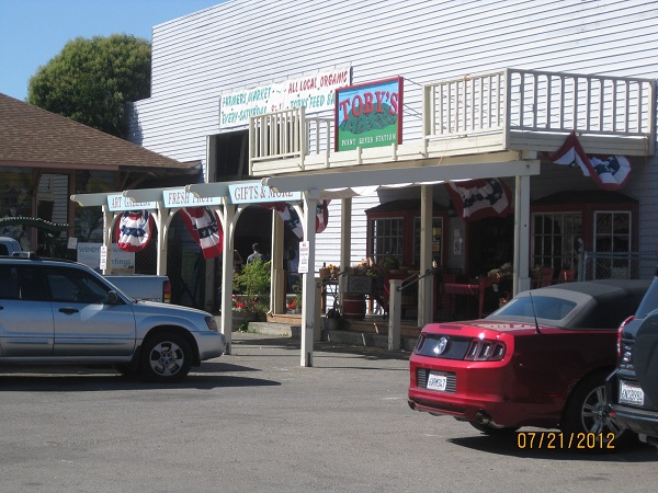
Another day we decided to make a trip to Reyes National Park. It is a peninsula located along the west coast just north of San Francisco. We started our exploration at Point Reyes Station, which is a very small town as you cross onto the peninsula.
 |
| Port Reyes Hardware Store |
There was a post office & hardware store, along with a few small restaurants & misc shops.
 |
| Creepy Tree we saw on the mountain |
 |
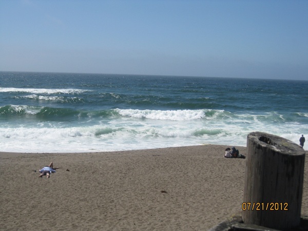
| Drakes Bay & The Pacific Ocean |
Our travels around Point Reyes Park took us thru several types of terrain. We took a trip up a very narrow road to the top of Mt. Vision. The views were really spectacular. As Collins & I have said so many times, you can take all the pictures you want, but they never do the actual scenery justice. The day was clear & you could see Tomales Bay, Drakes Bay & the Pacific Ocean from the top. We enjoyed a picnic lunch while sitting on a log.
 |
| Tomales Bay |
 |
| Pacific Ocean at Point Reyes |
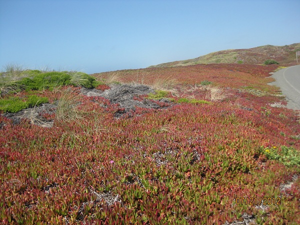 |
| Colorful Ground Cover along the beach |
The coastline was very rugged & where there was a beach, they suggested you not go in the water because the currents were so strong! We did notice as we drove down to the beach, they had a lot of groundcover growing in the sand. It was very colorful. The weather changes were crazy! It was in the 60’s the whole day there, but when we returned to our RV it was in the mid 90’s at 6pm.
 |
| Old Lifeguard Station in Drakes Bay |
 |
| California Hills |
 |
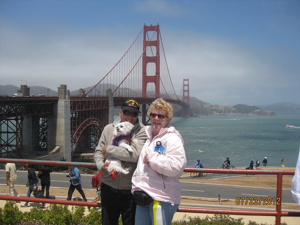
| Collins & Snuggles on the bridge |
We also decided to cross the Golden Gate Bridge. We were going to ride our bikes across, but heard the path to & from the bridge was very steep. Since we aren’t so good on our bikes anyway, we decided we’d better walk across. That was the best decision we could have made. They only had one side of the pathway opened & it was for pedestrians & bikers going both directions. I would guess, at it’s widest point, that path was no more than 6’. Just walking it was nerve-wracking. It was extremely windy, crowded & very noisy. It’s about 1.7 miles each way. At least we can say, “We did it!” Once is enough tho!!
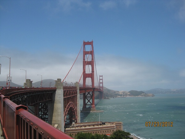 |
| Golden Gate Bridge |
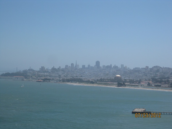 |
| View of San Francisco from the Golden Gate Bridge |
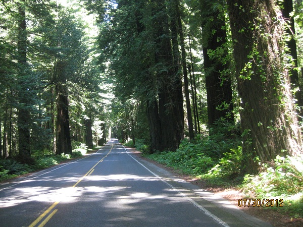
July 26th we said goodbye to the San Francisco area & pointed ourselves to the north. Since we were about an hour outside of San Francisco, we decided to take the Interstate instead of Hwy 101. We knew it would be 2 lane in many places & usually a fair amount of traffic. Big mistake!! The interstate was great , but when we got to Redding, CA we were in for a “bad trip.” We should have checked more closely, which I now do, but we had to go thru the Trinity Mts & that was not a fun trip. We’ve driven thru a lot of Mts in the past 2 years, but no road as bad as that. It was twisty & turning the whole way, which was about 125 miles. You think, ok maybe 2 hrs, It was closer to 4. It was 2 lanes most of the trip & sometimes I wasn’t sure if we were going to kiss the Mts next to us or go over the cliff. Many places had almost no shoulder & no guardrail. We were exhausted when we finally arrived in Trinidad.
We chose Trinidad so we could see the Giant Redwoods. Trinidad is a small, rocky coastal bay town. The weather wasn’t great for beach time, but we did take a couple of strolls.

There was an area called Agate beach right next door. Apparently, if you know what you’re looking for, there are plenty of agates, which are gemstones, to be found there. They aren’t polished like you get in a store so it’s hard to tell if you’ve just found some pretty rocks or you actually have agates. I came away with a handful of pretty rocks & maybe one or two are actual agates!
 |
| Patrick's Point, Trinidad |
We chose Trinidad so we could see the Giant Redwoods. Trinidad is a small, rocky coastal bay town. The weather wasn’t great for beach time, but we did take a couple of strolls.

There was an area called Agate beach right next door. Apparently, if you know what you’re looking for, there are plenty of agates, which are gemstones, to be found there. They aren’t polished like you get in a store so it’s hard to tell if you’ve just found some pretty rocks or you actually have agates. I came away with a handful of pretty rocks & maybe one or two are actual agates!
 |
| Gravel Road to Fern Canyon |
One day we drove North. We saw redwoods & drove to a place called Fern Canyon. I thought Collins was going to kill me by the time we arrived there. It was about 10 miles back on a pot holed, gravel road (reminded us of Costa Rica).
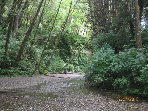 |
| Fern Canyon |
The canyon was pretty, all different kinds of ferns growing on the walls.
 |
| Fern Canyon |
We also saw a field full of Roosevelt Deer. Most of them were lying down or too far away for good pics. We were close to the State Park so one day we walked over just to see what we could of the beach – not much!
 |
| Food locker in bear country |
There was tent camping on that beach & I took a picture of the locker people had to use to store their food. There are bears in most of the forested areas up there & those lockers prevent them from seeing or smelling the food. It helps keep them out of the area.
It was in the 60’s our whole time there, & we didn’t see much sun. I guess that is pretty common for that area. We did meet some nice people in the park tho. That park had many wild blackberries growing & they were just ripening, so we picked several bowls full. One day I made a pie & we froze the rest for another one. My sister, Diane, had given me a pie crust recipe you don’t have to roll; you make it right in the pie pan. It’s so easy, I don’t mind making pies (not that I do it often).
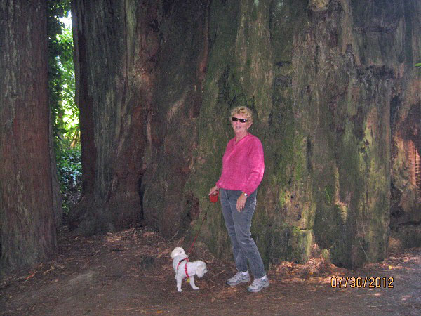
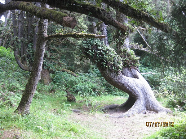
The redwoods are the tallest trees in the world. They can grow to about 380’ & live about 2000 yrs. We were amazed at their size.
 |
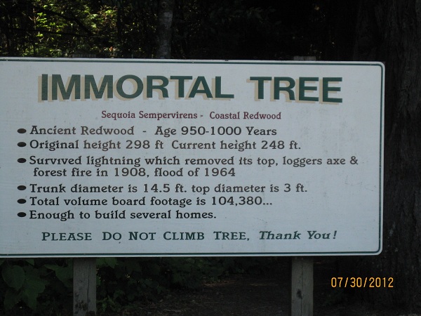
| The Immortal Tree |
One was called “The Immortal Tree”. It was over 950 years old & had been thru lightning, fires & floods. It is still growing!

Another, called the Eternal Tree, was over 2500 years before it was reduced to a stump. A 20’ room was built in that stump. The stump continues to parent new off shoots.
 |
| Inside the Eternal Tree House |

Another interesting stop along the way was called Founder’s Grove. It was dedicated to the founders of the Save the Redwoods League from 1917. It was a very peaceful, interesting place to see.
 |
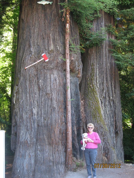
| Collins by the roots of the Dyerville Giant |
One of the most interesting, was a fallen tree called the Dyerville Giant. It was 370’ tall, 17’ in diameter & 52’ in circumference.
 |
| Karen next to the trunk of the Dyerville Giant |
It fell when the soil became too saturated during a rainy season. No one saw it fall, but a park neighbor about a mile away heard it & said it sounded like a train wreck. We didn’t get to the tree you could drive thru, but there are several in the area.

Along our route, there were several interesting little towns. Scotia is an old lumber town. Most of the 270 hillside homes all look alike & were built between 1920 & 1950.

There is still a huge lumber mill on the outside of town.
.JPG)
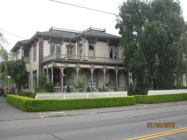
We also drove thru the Victorian Village of Ferndale. Much of the downtown & many of the surrounding homes have preserved their historic features.


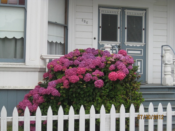
Many of the homes had huge Hydrangea Bushes in beautiful shades of pink & blue.
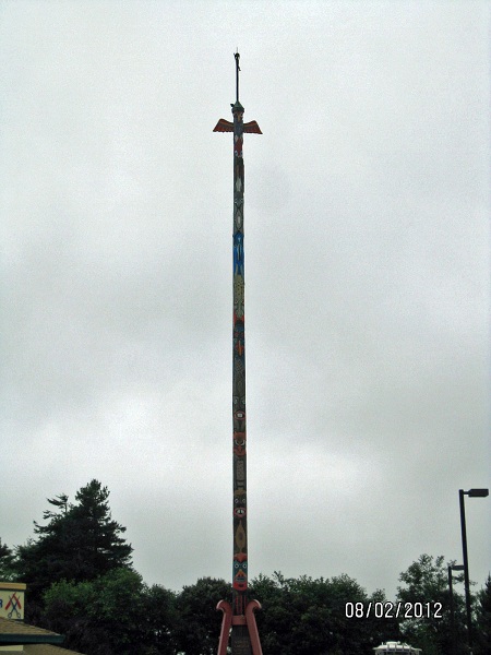
Another day, we drove to McKinleyville to do some shopping. They have what is said to be the world’s tallest Totem Pole carved from a single tree. The tree itself is about 500 yrs old.
 |
| Totem Pole Top |
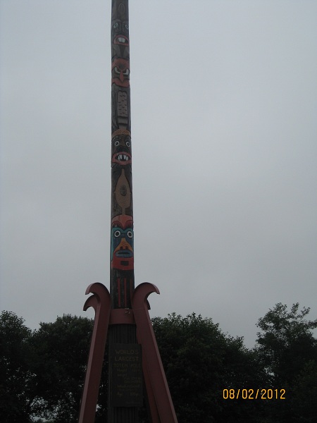 |
| Totem Pole Bottom |
Aug 4th our week in Trinidad came to an end & it was time to move on to Hat Creek, CA, located just outside the Lassen National Volcanic Park. Unfortunately, we had to go back across HWY 299. I’ll just say it was another long & hair raising experience. The only good thing I can say is some of the views were very pretty.

As we rolled into Redding, the RV came to a complete stop at a very busy traffic light. Several dash lights came on & we didn’t know what was going on. We spent a very hot couple hours waiting for a tow truck & getting hooked up. While we waited, we had a Redding Fire Truck & Police car behind us. Those people were so nice & they were the ones who got us a tow truck, when Good Sam said it would take 2 hours. It’s pretty fascinating to watch them get an RV our size ready to tow. Since it was late Sat. afternoon, they towed us to a campground for the weekend, hoping to find us a mobile mechanic. Of course, that didn’t happen, so we spent the weekend in Redding. Monday morning, Good Sam tried to find us a mobile mechanic willing to take on our unknown problem. We finally ended up being towed to a Cummins repair shop, where we spent Monday night. Tuesday, they figured out we had gotten air in the fuel line & something to do with the changes in air temp, caused things to lock up. It did change our plans for a few days, but it was no big deal. We met another couple in that park, that had come from another mountain road, They got too close to the mountain on one of the turns & ended up tearing off the back door on one of their cargo bays of their RV & the side fender on their car & puncturing 2 car tires. They were on a 2 lane road & couldn’t go anywhere. They had to wait for a tow truck on the side of a mountain.
By Tues afternoon we were back on the road to our destination in Hat Creek. What we didn’t know, was the park we wanted to see was shut down due to a forest fire. Besides that, we were about 25 miles from there & every morning we woke up with smoke in the air. Most days it blew away by noon, but one day it was smoky all day & there was ash everywhere. On top of that, we had no cell service there & our own mifi didn’t work, so we had to use their internet & we were only given 2 hours a day, which had to be used at one time. And it was soooo slow. We felt so disconnected. Whenever we went sightseeing we took our computers & phone.
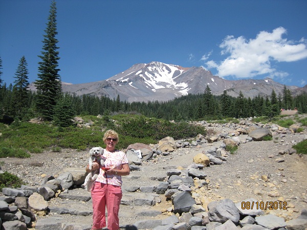
We did go to Mt. Shasta, which still had snow on the top. We took a picnic lunch & drove as far as we could up the mt.
 Mt. Shasta is a 14,162 foot volcano. Most of the area around it is rather flat so it really stands out! There is a lot of skiing in that area!
 |
| View from Mt. Shasta |
 |
| McCloud Waterfall |
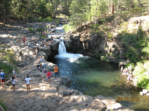
On the way home, we stopped at some pretty waterfalls. I don’t know what it is about waterfalls, but everyone seems to like them.
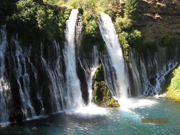
Another day we took a trip to another park that had a really beautiful waterfall, called McArthur-Burney Falls.

Theodore Roosevelt called it the 8th wonder of the world. It pours out an average of 100 million gallons of water per day, even in the summer & drops 129’.
Since we were trying to do things away from our smoky campground, we also paid a visit to Medicine Lake, which was formed by the Medicine Lake Volcano. It was very quiet there & not many people. Getting there was very interesting. The area around it is all volcanic rock. Some areas looked like freshly plowed dirt, but upon a closer look, it was rock. It provided us with a great drive for the day. You might be asking why we didn’t just leave Hat Creek, since it was smoky & we couldn’t go to the park anyway. Well, the crabby lady who ran Rancheria RV Park, wouldn’t give any refunds, so we just decided to stay & do the rest of the planned sightseeing from there. There were a number of people who left there quite unhappy.

Just a little unusual addition here. I’m including a picture of Belted Cows. We saw them for the first time in California, but they were too far away to take a picture. When we first saw them, we wondered if someone had painted them. I had to look them up online to see what they were. Anyway, they had some in a pasture as we drove by, so we stopped to take a picture.
Aug. 15th we left smoky Hat Creek & aimed for an area just south of the Oregon border called Tule lake, CA. We were planning a stop at the National Lava Beds National Park. We’re following the Volcanic Legacy Scenic Byway. Most of what we’ve seen since our arrival in Hat Creek has been part of that byway. Tule lake was a tiny town just south of the Oregon border in CA. Their fairgrounds had a great little RV park with full hookups & the greenest, thickest grass we’ve seen in a long time. Snuggles had a great time running around there. There were spaces for about 25 RV’s, but there were only 3 of us. --Tule Lake was the location of the largest of 10 Segregation Camps built during World War II to house Japanese Americans (2/3 were American citizens). They were held for over 4 years without ever being charged of any crime. We didn’t go to see these, it was too disgusting to even think about seeing it.
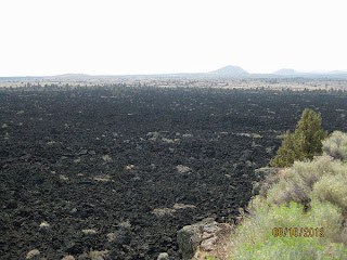
The Lava Beds Monument was formed by a shield volcano called Medicine Lake Volcano, which last erupted about 1000 years ago.
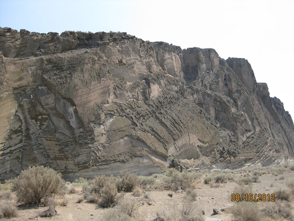
The land wasn’t pretty like some forested areas, but had kind of a stark beauty about it. The rock formations were fascinating. You could see lava flow & rock shearing, etc.

There are about 700 Lava Tube Caves, with some that could be explored.

We went into several of them. They aren’t at all likes the caves in AR or KY.
Modoc Indians lived on that land for because it provided them with a natural fortress, a nearby lake, & plenty of waterfowl & game. If any of you have studied the Indians, this is where Captain Jack was captured.

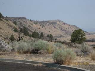
There is a small mountain just away from the main beds, that has very interesting rock formations to it.
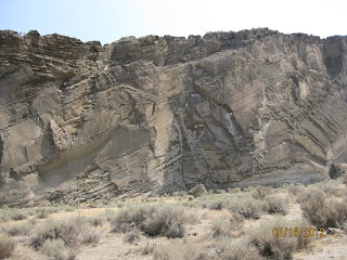
The side looks sheared & there are small cave like holes where many birds call home.

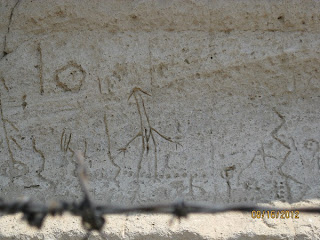
It is called Petroglyph Point because the Indians scratched many carvings (petroglyphs) into it. It would be interesting to know what they meant. After seeing this place, I was really sad that we hadn’t been able to get into Lassen Volcanic Park.

The Lava Beds Monument was formed by a shield volcano called Medicine Lake Volcano, which last erupted about 1000 years ago.
The land wasn’t pretty like some forested areas, but had kind of a stark beauty about it. The rock formations were fascinating. You could see lava flow & rock shearing, etc.

There are about 700 Lava Tube Caves, with some that could be explored.

We went into several of them. They aren’t at all likes the caves in AR or KY.
Modoc Indians lived on that land for because it provided them with a natural fortress, a nearby lake, & plenty of waterfowl & game. If any of you have studied the Indians, this is where Captain Jack was captured.

There is a small mountain just away from the main beds, that has very interesting rock formations to it.

The side looks sheared & there are small cave like holes where many birds call home.
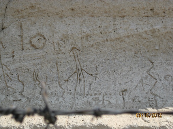
It is called Petroglyph Point because the Indians scratched many carvings (petroglyphs) into it. It would be interesting to know what they meant. After seeing this place, I was really sad that we hadn’t been able to get into Lassen Volcanic Park.
Aug 17th we crossed the border into Oregon. I’ve never been in this state before. We were booked into one of Oregon’s many State Parks, that provide full hookups (Electric, water & sewer) & can accommodate an RV our size. They are also very reasonably priced!!
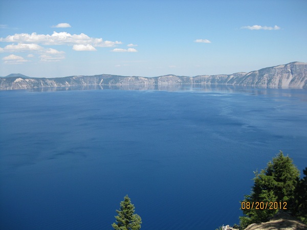
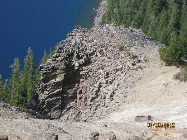
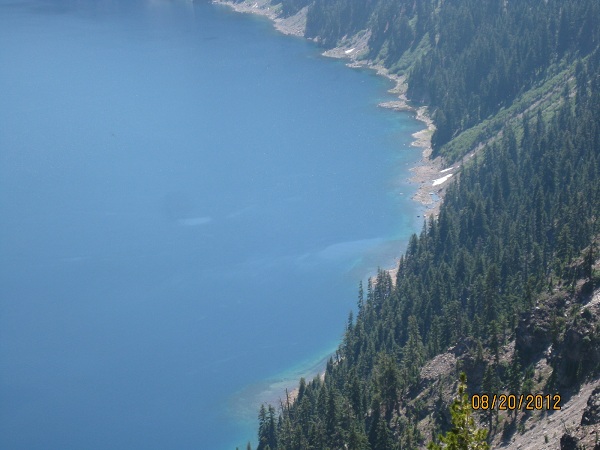
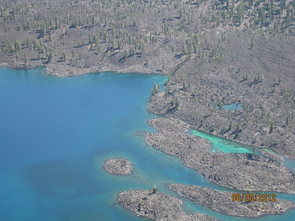
We’re in Collier State Park, which is about 40 miles south of Crater Lake. That was our main attraction for here. It is truly a spectacular sight! I will start by saying I could not take a picture to do it justice.
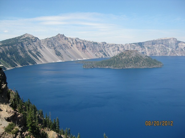
After the top of the volcano, Mt. Mazama, collapsed 7700 years ago, it created a caldera that filled with clear, blue water. It is really beautiful!! The color of the water comes as much from the sky as the waters depth. There are two small islands in the lake; the largest is Wizard Island. You can take a boat ride there & get out & explore if you like.
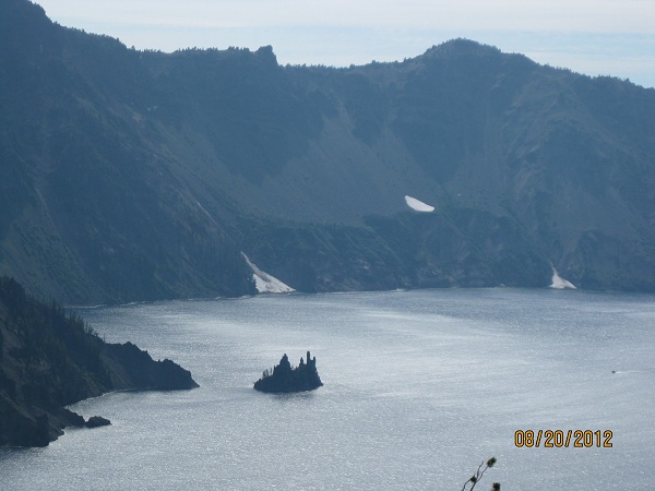 The second is called Phantom Ship. They say in certain light it is sometimes hard to see

The lake is the deepest in the U.S.; at its deepest is 1940 ft & 7th deepest in the world. It's so deep it has only frozen over once in the last 100 yrs.
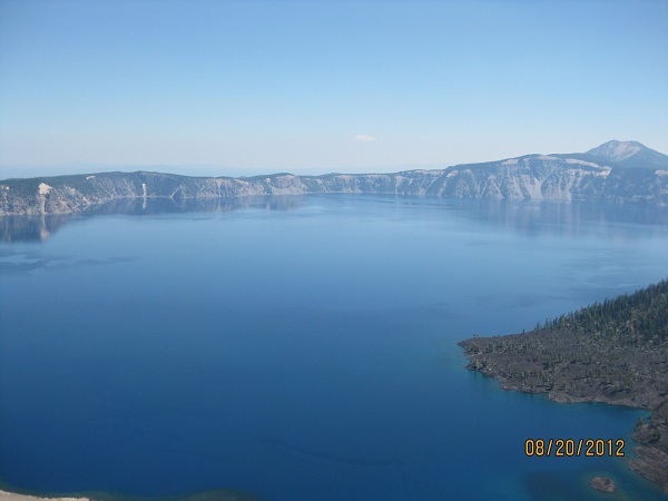
The rim measures roughly 6 miles across. Draw a circle on a local map representing a 6 Mile diameter; It was one very big volcano. The rim road is 34 miles & half it is closed 6 months of the yr. because it's not drivable.
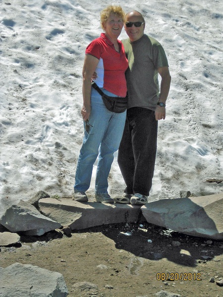
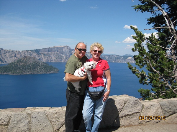
Avg snowfall is 44 ft., (see picture, & yes ,even though the temperature was 70*, that is remnants of last year’s snow we are standing in).
By identifying some of the far off mountains & other volcanoes, we determined we could see 150 plus miles. For Illinoisans, that would be from Elgin into Michigan, or Peoria.
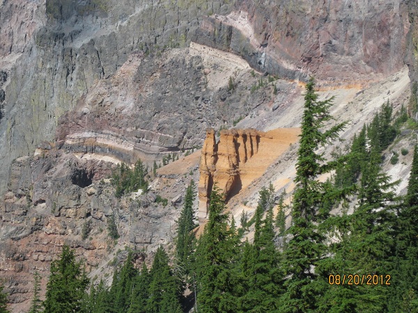
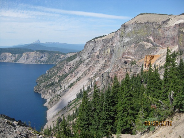
The various formations showing what occurred over the last 7700 yrs are a Geologists dream. This formation was callede Pummice Castle because the formation is made out of pummice. The colors in the surrounding rocks were really pretty.
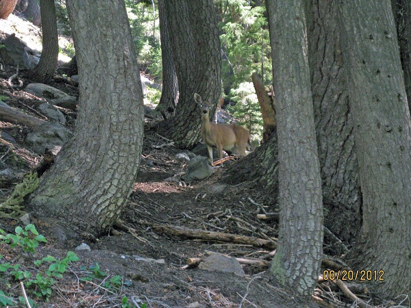
Just trying to grasp all of what had to occur is pretty amazing. Not surprising, the water is cleaner than what you get out of your tap. We took a short hike into one of the meadows that had a creek running thru it. Snuggles found the shallow water tasted very good. We also saw a deer in the woods!

On the exterior side of the mountains surrounding the lake, there were some interesting views including this one of Videa Falls.

While the northern California Big Trees were interesting, we have been more impressed in Oregon's sites. I'm sure this is nothing when compared to Alaska, but it's still very sobering. Every time we stopped at a lookout, all we could say was WOW! This particular range of Volcanoes we been following, the Cascades, goes all the way to British Columbia.
 |
| The water is coming up where you see the ripples |
 |
| Spring Creek, where the headwaters go |
We also took a drive to what they called the headwaters of a creek that ran nearby. It was interesting because there were all these spots you could see the water coming up from the ground. It’s hard to imagine those spots creating enough water for this creek.
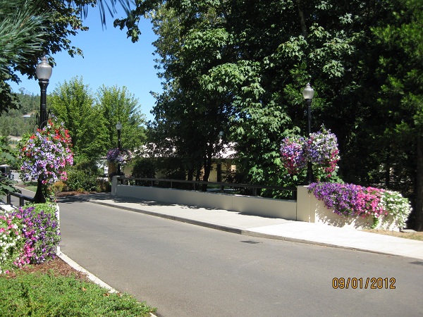
Aug. 28th we left Colliar State Park for a place suggested by several people we met along the way. It’s called Seven Feathers RV Resort. It’s part of a casino, but it’s across a busy highway.
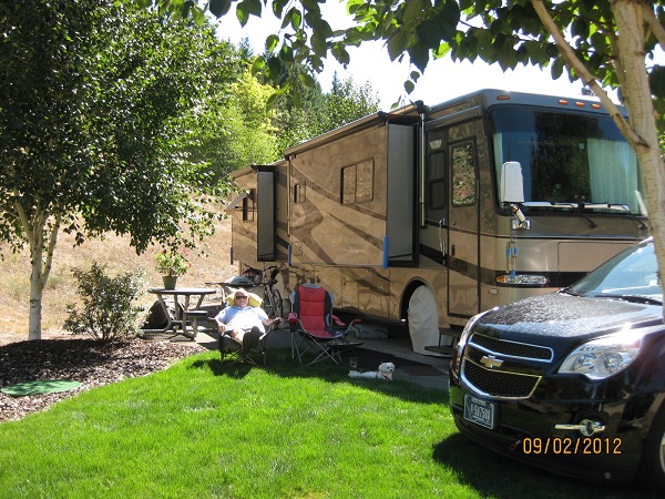 |
| Our spot |
This place is, by far, the nicest RV park we stayed in. The cement RV pads are well separated from our neighbors, sidewalks abound, the grounds are beautifully landscaped,with hanging pots of petunias all over & street lights that were the old 1800’s type.
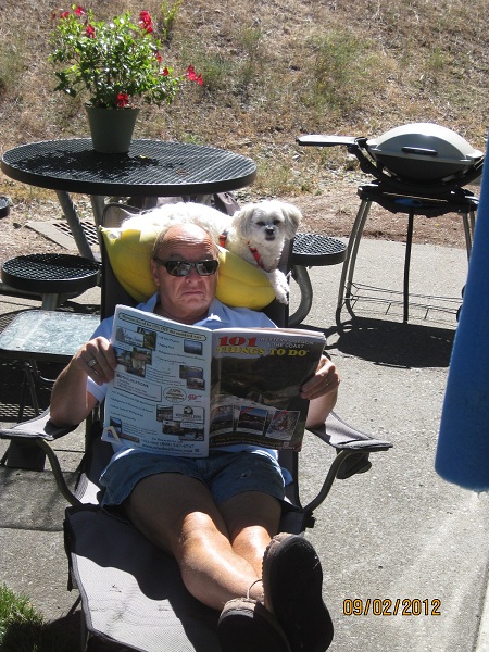 |
| Snuggles & Collins read the paper |

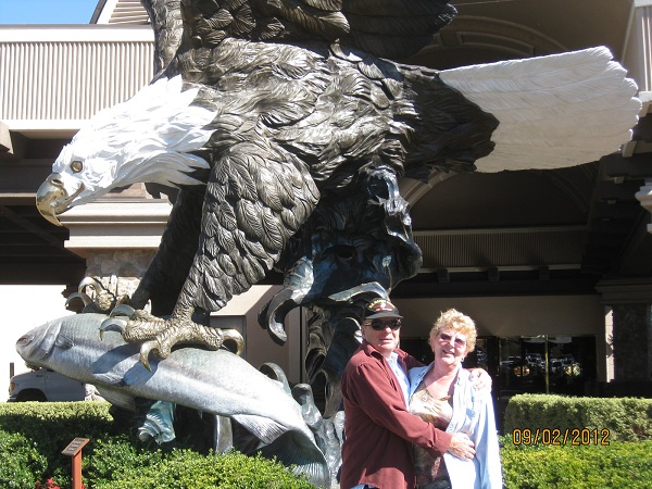 |
| Us at the Casino |
Life is good, & here it is very good.
We’ll be off to the coast for the next few weeks.
We’re going to head back to TX pretty soon to deal with a lawsuit we’ve filed against Convenience RV, who incorrectly installed the brake cable that caused our car brakes to burn out as we started this year’s travel.